Pilot reforestation technique via drone for the first time in Greece
This is an innovative analysis technique that he applied at the University and one of the first times in the world with the help of drones in selected exhibitions in Gerenia Ori.
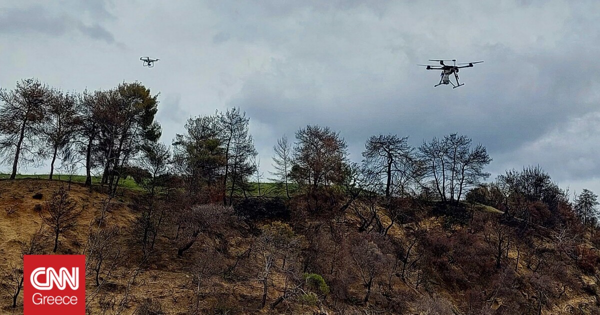
A few months after the great fire in Geraneia Ori in May 2021, a group of about 13 people from the Agricultural University of Athens, consisting of professors, auxiliary research staff and graduate students PhD candidates, was invited to contribute to the undertaking of the area using drones for sowing in difficult and inaccessible places which could hardly be reached by pedestrian sections.
The areas of 5-10 hectares in the events where the pilot consumption was carried out had different characteristics in terms of geological background, geomorphology, prevailing vegetation and soil characteristics and mainly they were mountainous areas with large morphological gradients and strong relief.
The team members in the first phase started a detailed recording of the prevailing vegetation and relief conditions in the area. By examining aerial photographs from different time periods, namely 1945, 1992 and 2014, they tried to see the changes over a period of up to 70 years.
As explained to the Athens/Macedonian News Agency, the dean of the School of Environmental and Agricultural Engineering of the Agricultural University of Athens and professor of Water Resources Management, Christos Karavitis, from the orthophoto maps they used were able to make the selection of the evolution of the vegetation. where the pilot reforestation technique. “We used the latest analysis methods to produce a digital relief model to see what terrain we have, if we have for example rocky areas, but also how much the area has been affected by the fire. After this mapping was done, the geological conditions were then analyzed to see if the area has a high risk of landslides or if it is going to have corrosion problems. Based on these criteria, we chose the areas in which we would act”, Mr. Karavitis, one of the group’s leaders, points out to APE-MPE.
First, as described, a sowing was done with seeds that sprout herbaceous vegetation to prevent corrosion.
“The planning of sowing was done using a drone, with a suitable container that had the drone on and in which various seeds were placed. The placed seeds were sprinkled with insecticidepesticide and were wrapped in a cotton film to help with moisture and placed in a clay (clay) capsule to which we added our University’s Biotechnology lab various fertilizers and growth aids. We planted seeds of carob, scotsupia, pine, cypress and cypress, seeds we selected from the Amygdaleza forest ginning plant”, notes Mr. Karavitis, adding that these are the species that they tried to experimentally see their vegetation in order to even prevent the soil erosion.
The forest seeds were enclosed in a specially shaped pellet consisting of clay, peat and other materials to hold the seed.
This pilot technique has previously been developed in flat areas of Australia, however it is the first time it has been found in areas with steep slopes and strong reliefs. At the same time, there is already interest from other universities in Europe, namely Portugal, Spain and Italy, to implement it on a pan-European pilot level.
According to the professor of Tectonic Geology, Geoenvironment and Natural Disasters at the Agricultural University of Athens and director of the Laboratory of Mineralogy – Geology, Ioannis Papanikolaou, whose Laboratory also participated in Research group of the GPA in agriculture n use of drones essential tool both in terms of crop monitoring and spraying.
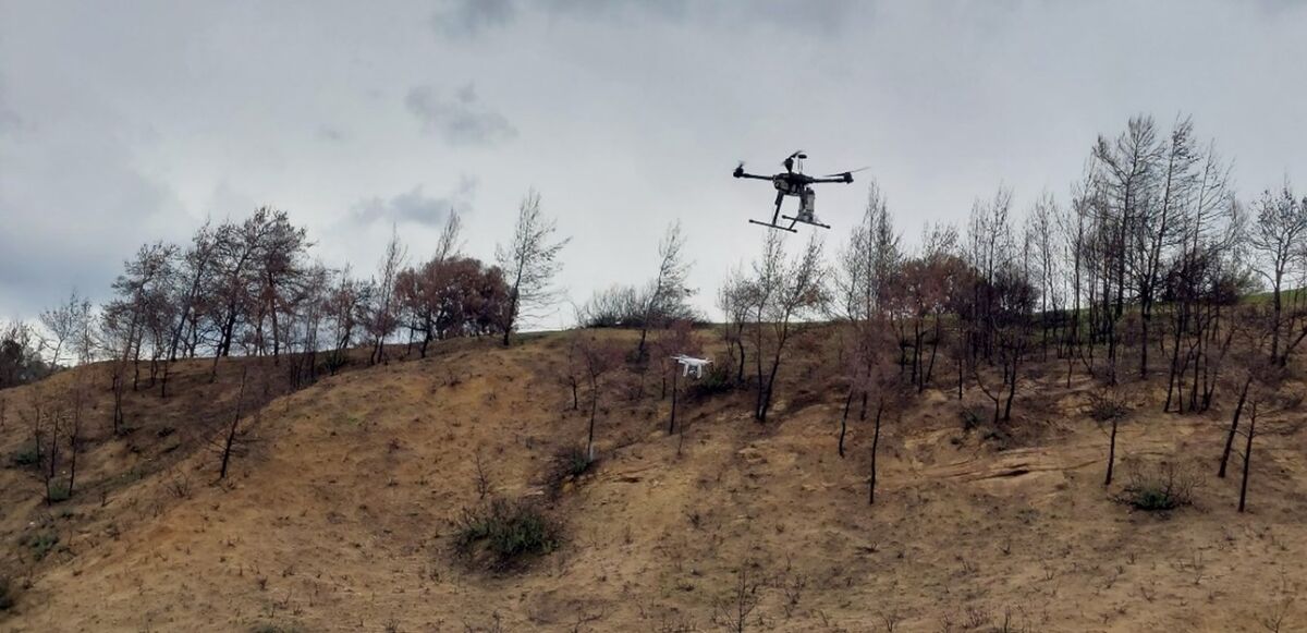
“With drones, we are given the opportunity to access areas outside the main road network that are more remote or difficult to access due to high morphological gradients, and at the same time there is no land disturbance intervention. In areas where we have high burning intensity, the ground needs more protection. The fact that there is no soil disturbance intervention constitutes big advantage of using drones in consumption“, Mr. Papanikolaou emphasizes to APE-MPE, and adds that the action carried out had the character of anti-corrosion measures beyond the sowing for the takeover.
“It is a new technique that we want to try. The plan is to transfer successful practices of precision agriculture to forest ecosystems, with an emphasis on post-fire areas, which are of most interest to us since the plant cover has been destroyed, we are looking at how we can support regeneration but also prevent severe erosion phenomena. This is all pilot we will need different experimental sites and different geo-environmental conditions different geological backgrounddifferent geomorphological characteristics and different territorial characteristics”, underlines Mr. Papanikolaou in APE-MPE.
Important, as they explain, was also the contribution of the people of the Megara forest office, who with their experience and knowledge of the area effectively directed and helped the team of the Agricultural University of Athens. It is noted that the pilot takeover technique via drone in the Geraneia Mountains was carried out under the auspices of the Department of Forestry Projects of the Ministry of Environment and Energy with the sponsorship of Motor Oil Hellas.
/cloudfront-eu-central-1.images.arcpublishing.com/madsack/NUWZCWCJRJBIJHU5AUO5EXOHDY.jpg)

/cloudfront-eu-central-1.images.arcpublishing.com/madsack/NHW556UKZ5AVBM47OAWSYLJCPQ.jpg)