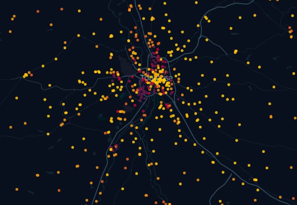
What the IPS map reveals in Toulouse
The classification of schools and colleges according to the social background of the students highlights the favored and disadvantaged areas of the municipality.
The geographer Jérémy Garniaux had fun geolocating nearly 39,000 schools in mainland France and overseas. The rendering will delight both cartography enthusiasts and sociology enthusiasts. The map distinguishes schools and colleges according to their social position index (IPS). “This spatialization tells a certain social geography of the country”, note the author of the map.
LIPS, What’s the matter ?
This index was created in 2016 by the Ministry of National Education to describe the average social background of students in an establishment. The index is integrated from the professions and socio-professional categories of parents. For example, a student whose parents are a school teacher and an engineer would obtain an IPS of 179, while another, with two unemployed parents, would be at 54. The ministry estimates that the higher the index, the greater the student evolves in a family context conducive to learning.
This tool is used to allocate resources to establishments according to their needs. Until this year, it was not publicly released by the ministry, which feared it would be used for school mapping. A court decision has forced him to do so since this summer, for colleges and CM2 classes, specifies The world, following a request from journalist Alexandre L . . .