Florence Weather 3-4 September 2022
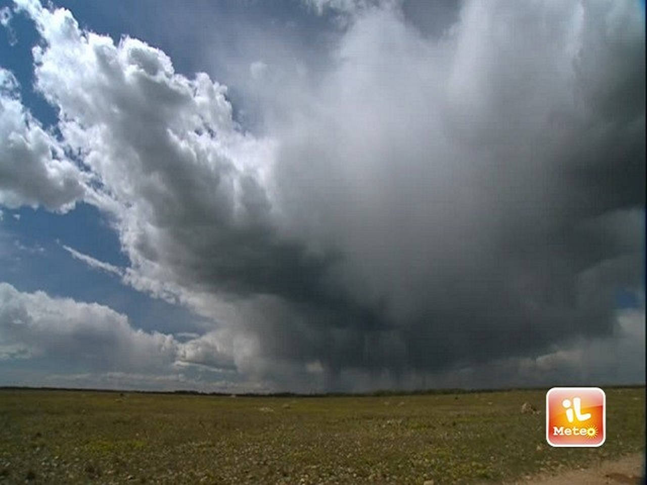
It will be a Saturday in which it will be necessary to stay up to date with the weather forecasts and with the updates of the Civil Protection. From mid-morning / early afternoon, explains meteorologist Francesco Del Francia of 3bmeteo.com, in fact, the probable genesis of a mesoscale convective system (MCS) is foreseen, that is a structured storm conformation of maritime origin moving from the Tyrrhenian towards the immediate Tuscan hinterland. The latter is accompanied by local storms / lightning floods, hail even of medium and violent gusts of wind (> 70-85 km / h); It will therefore be extreme caution outdoors. Clearly, the repercussions on the territory will be of a local nature and only for some areas or provinces, but which areas could be most at risk? As the image shows, they must be the western and central / south-western Tuscan areas (especially Elba-Archipelago coasts and sub-coasts) as well as those most subject to local but strong repercussions in terms of punctual storms and violent gusts of wind. On Sunday, between night and morning, there will still be sea storms, even strong ones, moving from Elba towards the nearby coasts and Argentario, in the afternoon instead we will find scattered instability (locally thunderstorms) in the inland areas, especially on the south-eastern ones.
About the city of Florence a little rain is expected on Saturday, especially in the central / afternoon hours with the bulk of the bad weather that should remain confined far to the West; possible, however, to improvise gusts of wind; maximum values down to 27-28 ° C. On Sunday scattered clouds in the morning, some unstable notes not excluded in the afternoon with rapid showers or thunderstorms. Temporary improvement by Wednesday with highs again over 31 ° C.
On Pisa I expect an unstable Saturday with the risk of fast but strong thunderstorms, punctual hailstorms and improvising strong gusts of wind. More structured phenomena should concern the western Tuscan areas located a little further south, considering the rather evolutionary dynamics (but with great potential) expected to remain updated with the forecasts also with the Civil Protection Bodies. On Sunday there are still some downpours or thunderstorms not excluded in the first part of the day, then a general improvement which should also extend to the first part of the new week.
On Livorno and its province we will notice a Saturday with the risk of strong thunderstorms, improvising strong gusts of wind and local hailstorms; even if it could be the central-southern sector of the province, in particular the Island of Elba / Apelago and the nearby coasts, the one most targeted by bad weather (with high hourly rates) and by the following potential problems; It will therefore stay up to date with planned and Civil Protection Bodies. On Sunday there are still sea storms, especially on the islands by the morning, then a general improvement which should also extend to the first part of the new week.
On Arezzo and the province there are showers or local thunderstorms on Saturday afternoon, especially in the western / south-western areas of the province; real bad weather should remain confined further west; possible, however, to improvise strong gusts of wind. Sunday low or irregular clouds in the morning, very likely showers or thunderstorms in the afternoon with local hailstorms. Temporary improvement by Wednesday with highs again over 29-30 ° C.