Low water level: the 680 km of the VNF Nord-Pas-de-Calais network under surveillance
——————– ADVERTISING ——————–
Water-saving measures have been taken on this highly artificialized network and extensively instrumented.
Currently, water levels are under pressure in the Aa delta, due to drought and heavy pumping linked to irrigation. On the canalized Aa, downstream of the Flandres lock, the level (2.26 m) is thus 4 cm lower than normal. Water transfers are carried out from the Lys sector to maintain this level. In the south of the department, on the Canal du Nord and the Canal de la Sambre à l’Oise, pumping at the locks has been set up to compensate for water transfers from the upstream reaches to the downstream reaches during boat passages. . At this stage, the situation, although in tension, is under control, allowing the maintenance of navigation and other uses of the water to which it contributes, while guaranteeing the preservation of the environment.
Interconnection of 6 sub-catchments
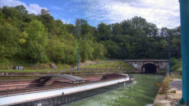
VNF Nord-Pas de Calais manages 680 km of navigable waterways, including nearly 250 km of wide-gauge waterways. This network is made up of 90 locks, more than 100 water level regulation structures and 2,000 hectares of public river property. Delimited, to the south, by the hills of Artois and Cambrésis, it flows towards the sea (Aa) or Belgium (Deûle-Lys, Escaut, Sambre) and collects nearly 80% of the surface waters of the departments North and Pas de Calais.
The network of natural rivers has been heavily artificialized over the centuries, and supplemented by a network of canals intended to meet the needs of the populations (water supply of the cities of Douai then Lille in the Middle Ages, military or commercial needs later) . This network now makes it possible to interconnect six sub-watersheds (Escaut, Scarpe, Deûle, Lys, Aa, Hem) and to carry out, within the limit of the capacity of VNF works (dams, locks, pumping systems ) water transfers between the different sub-catchments.
water transfers
This channeling of surface water is essential to protect the environment. It is also essential for human activities. The Aa delta (Calais-Saint-Omer-Dunkirk triangle) does not have sufficient water resources to meet the needs of agricultural irrigation and industries (Dunkirk area) at low water levels. ). Water is brought in from other basins via the VNF canals and the Fontinettes lock in Arques.
Monitoring by sensors 7 days a week and 24 hours a day
The VNF network, equipped with sensors, makes it possible to know, in real time, the water level in rivers and canals. This data is consolidated in a monitoring tool, which can be consulted at all times by a team providing on-call duty 7 days a week, 24 hours a day, to react quickly to hydraulic events. The complete history, established from the required information, feeds the studies and the simulations in order to follow the flood and low water phenomena and to better anticipate them.