Weather: The “polar ball” is coming – Cold two days in Athens – Where will it snow
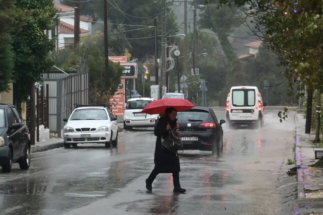
She is noticeably falling temperature from the evening hours even on Tuesday (24/1), with “political ball” as it has been characterized, to make its “presence” felt in Athens as well and to reserve a difficult two days.
As mentioned by Sakis Arnautoglou in ERT, snowfalls are expected in western Macedonia, Epirus, in the mountains of Trikala and Karditsa, but also in Evrytania, Aitoloakarnania and Fokida, while from the morning of Wednesday (25/1) they can be seen in the west of the country and also in the east of Thessaly.
From noon onwards, clouds are expected everywhere and the rains will intensify in the Ionian Islands and Epirus. In the evening the weather deteriorates further in the west with even more intense rain and storms. Winds in the Ionian will blow from the East at an intensity of 7-8 Beaufort and in the Aegean from the North at 5-6 Beaufort. The temperature at 12 in the central, at 5 to 9 in the north, at 12 in the Ionian and at 11 to 12 in the Aegean. In Attica, cloudy from the morning and from the afternoon onwards, the clouds will thicken even more. The temperature from 10 to 13 degrees. In Thessaloniki it is also cloudy since the morning. We will have rain in Pella, Imathia and Pieria, while snow will fall in the mountains. The temperature from 7 to 11 degrees.
Marousakis’ prognosis
According to the weather forecast, Thursday and Friday will be the most dangerous days for Attica, with possible problems from heavy rains and storms.
In particular, in his post, the meteorologist Clearchos Marousakisrefers to a “political ball” that will hit the whole country, which will cause severe bad weather, with the main characteristics being heavy rains and heavy snowfalls even at low altitudes.
“Polar air mass in the middle atmosphere (about 5.5 km above mean sea level) trapped for several days in the area of Italy, causing successive waves of bad weather as it swirls around itself.
Two repeated bad weathers have hit our country in the next 24 hours (Wednesday night to Saturday morning – noon) capable of causing significant problems”, says Klearchos Marousakis initially in his post.
“The main features of these waves of bad weather will be heavy rain – storms, heavy snowfall even at low altitudes towards the central and northern mainland, locally gale force winds as well as a drop in temperature especially from Thessaly and further north”, notes Clearchos Marousakis.
“According to the new prognostic data of the bad weather that will “hit” our country in two phases.
THE FIRST PHASE it will start from the afternoon and from the west to the east and by late Thursday night it will tend to complete its action towards the islands of the Eastern Aegean.
THE SECOND PHASE it will start towards the dawn of Friday and from the south-west to the north-east and by the morning – noon of Saturday it will tend to complete its action towards the islands of the eastern Aegean and the north-east continental parts”.
In more detail according to the EMY:
On Wednesday (25-01-2023)
1. Heavy rains and storms are foreseen: From the late afternoon in the Ionian islands (mainly in Zakynthos, Kefallonia, Lefkada and Ithaca), the north-western Peloponnese, the western mainland and from the night in Epirus.
2. Snowfall will occur in the continental mountains, from the evening which is thick in places in western Macedonia, in the mountainous and semi-mountainous areas (indicative altitude of 800 meters and above) of Epirus, western and central Sterea, central Macedonia (in western parts) and Thessaly (in the western and northern parts).
3. Winds will locally reach the Ionian at 8 to 9 Beaufort.
On Thursday (26-01-2023)
1. Heavy rains and storms are forecast:
a) until noon in the Ionian Islands, Epirus, western Sterea and western Peloponnese.
b) from the morning hours in the eastern Peloponnese and gradually in the eastern Sterea (including Attica), Evia, Thessaly and the Sporades. From the late afternoon and from the west the effects will weaken
c) from the afternoon in the Cyclades, Central Macedonia, Eastern Macedonia and from the evening in Thrace and the islands of the Eastern Aegean.
2. Snowfall will occur in the continental mountains which are dense in places (with an indicative altitude of 600 meters and above), in western Macedonia, Epirus, western and central Sterea, Evia, Thessaly, central and eastern Macedonia. . Heavy snowfall will occur in Thrace (indicative altitude of 400 meters and above).
3. The winds will reach locally in the Aegean at 8 to 9 Beaufort.
On Friday (27-01-2023)
1. Heavy rains and storms are forecast:
In Thrace, the islands of the eastern Aegean, the eastern Cyclades and the Dodecanese which from the afternoon will be limited to the southeast.
2. Snowfall will occur in the continental highlands, in the morning hours which are thick in places in the highlands and semi-mountains of eastern Macedonia and Thrace (indicative altitude of 400 meters and above) with the gradual decline of the phenomena.
3. The winds that locally reach the eastern Aegean at 8 to 9 Beaufort with gradual weakening.
More details on the development of the weather in the regular and emergency weather bulletins, on the website
of EMY (www.emy.gr) and EMY’s twitter account (@EMY_HNMS).
The latest News
Read them first News about what is happening now in Greece and the World at thetoc.gr