San Marino. Weather: the unstable flow of Arctic-sea wind continues towards the Mediterranean
Also during the weekend, cold arctic-maritime currents will continue to descend, which will keep a low-pressure circulation active in the central Mediterranean. A minimum depression will form between the Ligurian Sea and the Lower Tyrrhenian Sea. A very dynamic weather situation remains, therefore susceptible to sudden changes with passages of fast precipitation predictable only a few hours after the event.
Saturday day it will be with a sunny sky, then during the day the cloudiness carried by the minimum rotating depression on the Ligurian Sea will increase. Therefore moderate winds will blow from the southwest and the temperature will remain slightly above freezing.
Sunday day it will pass between heavy and clear clouds, the temperature will remain almost stable and the winds will rotate in the course of the evening / night from southwest to north / northwest.
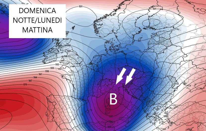
Between Sunday night and Monday morning a new unstable front will arrive pushed by cold northern winds that could bring instability on San Marino with fast snow showers at high hilly altitudes from Romagna downhill towards the Marche. Forecast to be confirmed in hours.