First high-resolution cadastre for solar potential in the state of Salzburg — ZAMG
The spatial data infrastructure and energy management departments of the state of Salzburg have in common with GeoSphere Austria (formerly ZAMG) revised the solar potential cadastre. Salzburg is now the first federal state in Austria to be able to offer its population data that shows, through high-resolution laser scans, where a photovoltaic-plant makes the most sense.
Salzburg is the first federal state to offer data on the solar potential in extremely high resolution (hourly and with an accuracy of 0.5 to 1 meter), for example to assess the suitability of a property or roof area for a photovoltaic system. Even small-scale shading effects are taken into account. The data based on calculations by GeoSphere Austria (formerly ZAMG).
Also very small-scale Effects considered
The STRAHLGRID radiation model from GeoSphere Austria served as the starting point for the calculations. It takes into account different components of solar radiation (such as direct and diffuse radiation) on any inclined surface. Effects such as clouding of the atmosphere due to water vapor and aerosols, cloud cover, shadowing by the horizon as well as terrain and multiple reflections (e.g. due to snow) are also taken into account.
This radiation data was converted by GeoSphere Austria in a complex process to very detailed terrain data from Salzburg in order to take even small-scale effects such as shadows from buildings and groups of trees into account. The terrain data comes from laser scans of the state of Salzburg during area-wide aerial surveys. The entire federal state was recorded with an accuracy of 0.5 to 1 meter.
Calculation only possible on a high-performance computer
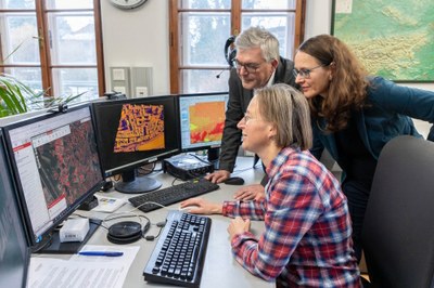
“Thanks to the very detailed physical and spatial modelling, the effects of nearby shading, for example from neighboring buildings, could also be taken into account for the first time,” says Claudia Riedl. “The very high spatial and temporal resolution was also a computational challenge, because the new data set comprises 450 terabytes. Modeling on this scale is only possible on a few high-performance computers in Austria.”
Important for Salzburg’s climate strategy
The data is free and freely accessible. “Each additional photovoltaic system makes a valuable contribution to climate protection. The solar potential of each individual roof area can be researched quickly and easily in the new free cadastre. In this way, we support the switch to renewable energies and the sales of the goals of the Salzburg master plan Klima+Energie Salzburg 2030″, says Deputy Governor Martina Berthold.
Estimated to be faster
“Every citizen can now get an idea of how much sunlight shines on their roof and which area of the building under consideration is best suited for a photovoltaic system. In this way, the potential can be read easily and uncomplicatedly and I hope that many systems will be implemented, because we will need everything,” says Salzburg’s Provincial Councilor Josef Schwaiger.
—
Claudia Riedl (GeoSphere Austria) with Salzburg Deputy Governor Martina Berthold and Provincial Councilor Josef Schwaiger at the presentation of the new solar potential cadastre. Source: State of Salzburg/Neumayr/Hofer -> full resolution
—
State of Salzburg: https://service.salzburg.gv.at/lkorrj/detail?nachrid=68007