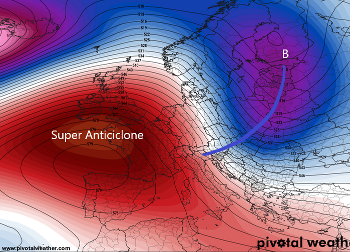
San Marino. Weather: increased cloud cover between Friday and Saturday, but the Anticyclone does not take a step back
This long and anomalous anticyclonic phase does not see an end, indeed during the first days of next week the Anticyclone will further strengthen right above central-northern Italy, further extending the drought period.
On Friday and the passage of a disturbed front on the eastern edge of the anticyclone will bring cloudiness on the Italian Adriatic side and in San Marino the sky will be covered with clouds associated with weak and localized weak precipitations. Temperature between 3/4 ° C and 7/8 ° C.
Fog increasing in the first part of the day on Sunday, due to the stagnation of humidity in the lower layers of the atmosphere. The temperature will tend to drop slightly on Sunday morning, reaching around zero. During the day, on the other hand, the thermal values will increase over 10 ° C thanks to the amount of sunshine.
Next week it will remain stable, the Anticyclone will further strengthen, so we still have sunny days, with increased fog and no precipitation. The temperature fluctuates between 0/1 ° C in the morning and 10/12 ° C in the central hours of the day.