Western Greece: Bad weather has begun – Storms in Patras, relaxation in Ilia [εικόνες & βίντεο]
Severe weather conditions occurred in Western Greece, with storms and hail making a strong appearance today, Saturday morning.
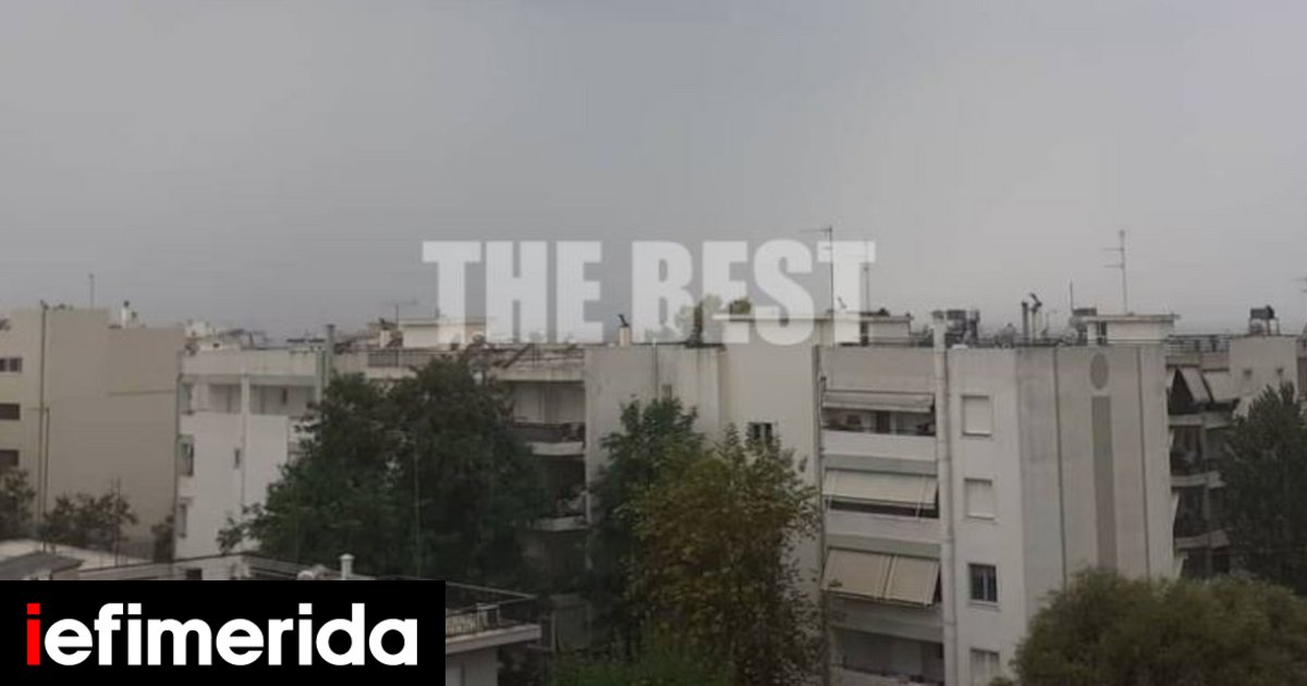
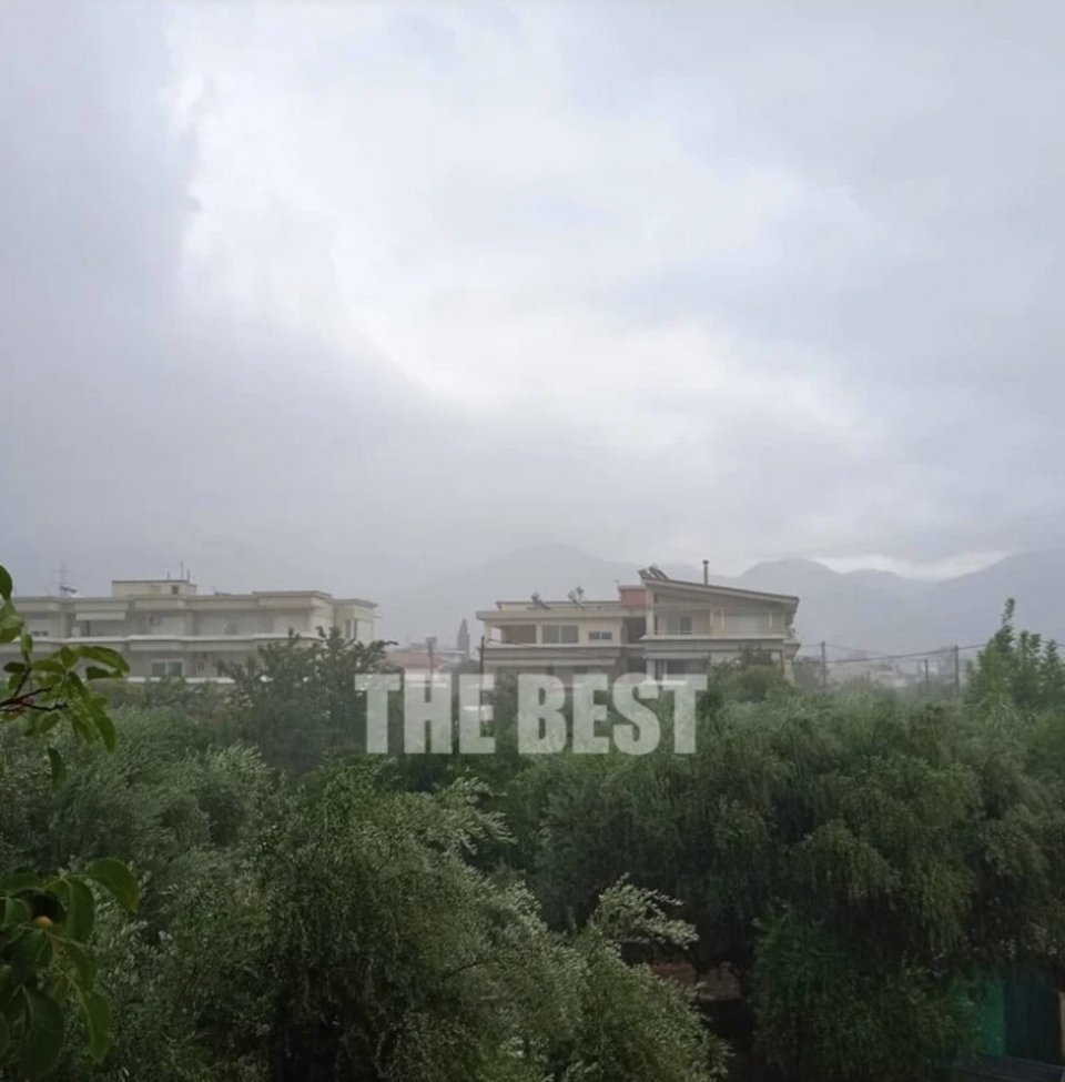
A short time ago, on Saturday morning, heavy hail started in Ilia, while at the same time heavy rain also occurred in Patras. Specifically, as can be seen in the video, a car moving on E.O. 111 Tripolios-Patron, passes through the village of Lampeia in Ilia, in the midst of strong hail that significantly limits the visibility of the vehicle.
According to thebest.gr, the heavy rain started a while ago, on Saturday morning, in the area of Patras from the eastern districts.
The morning shower was the first of a series of rainy visits that are expected in the next few hours in the area.
See images and videos of the rainfall in Patras:
How will the weather be until August 15th?
Heavy rains and storms are predicted for today Saturday in many areas of the country. Hailfall in Macedonia, Thessaly and Ionian.
Locally heavy rains and storms accompanied by a high frequency of lightning and possibly hail in Macedonia, Thessaly and the Ionian. Sporadic rains and storms in the midday and afternoon hours and in the rest of mainland Greece.
In the eastern island country generally clear weather. The winds will blow in most areas north northwest 3 to 5 and in the eastern and southern Aegean locally up to 6 Beaufort. The temperature will drop slightly in the Ionian and continental regions.
MACEDONIA, THRACE
Weather: In Macedonia, clouds temporarily increased with local rains and from the midday hours sporadic storms that are strong in places and will be accompanied by a high frequency of lightning and possibly hail.
In Thrace a few clouds that will increase after noon and there will be rain and isolated storms.
Winds: Northerly 3 to 5 Beaufort.
Temperature: From 18 to 32 degrees Celsius. In western Macedonia 3 to 4 degrees lower.
IONIAN ISLANDS, EPIROS, WEST STEREA, WEST PELOPONNISOS
Weather: Increased cloudiness with sporadic rains and storms, until noon in the Ionian, which are strong in places and accompanied by a high frequency of lightning and possibly hail.
Winds: Initially southerly 3 to 5 Beaufort and from noon northwesterly with the same intensity.
Temperature: From 20 to 32 degrees and in the interior of Epirus up to 28 degrees Celsius.
THESSALIA, EASTERN CONTINENTA, EASTERN PELOPONNISUS
Weather: Locally increased cloudiness mainly in the midday and afternoon hours with rain and storms, which in places in Thessaly are strong and accompanied by a high frequency of lightning and possibly hail.
Winds: Variable 3 to 5 Beaufort.
Temperature: From 18 to 33 degrees Celsius.
CYCLADES, CRETE
Weather: Generally clear and only in western Crete a few temporary clouds will develop.
Winds: Northwest 4 to 6 Beaufort.
Temperature: From 22 to 30 degrees Celsius.
EAST AEGEAN ISLANDS – DODECANISE
Weather: Generally clear.
Winds: From north directions 4 to 6 Beaufort.
Temperature: From 23 to 32 degrees Celsius.
EUBOEA
Weather: In the midday and afternoon hours increased clouds and sporadic rains. In the morning and in the evening almost sunny.
Winds: From north directions 3 to 5 Beaufort.
Temperature: From 21 to 32 degrees Celsius.
ATTICA
Weather: A few clouds that will increase in the midday and afternoon hours and there may be light rain.
Winds: Variable 3 to 4 Beaufort.
Temperature: From 25 to 33 degrees Celsius.
THESSALONIKI
Weather: Clouds at times increased with rain and from noon sporadic storms, which may be intense in places.
Winds: North northwest 3 to 4 Beaufort.
Temperature: From 22 to 30 degrees Celsius.
FORECAST FOR SUNDAY 14-08-22
In Ionia, Epirus, western Sterea, Macedonia, Thessaly, the Sporades and gradually in eastern Sterea (including Attica), Evia, Thrace and the northeastern Aegean, clouds with rain and sporadic storms are forecast. The phenomena that will be temporarily strong in the area will gradually weaken from the late afternoon and in the evening will be limited to the northeast.
In Peloponnese and Crete few clouds, temporarily increased with local rain or isolated storms. The eastern island country is forecast to have generally clear weather.
The winds will blow north northwest 3 to 5 and in the west and south seas west northwest locally up to 6 Beaufort. The temperature will drop slightly mainly in the west and north where it will reach 29 to 31 degrees Celsius. In the rest of the mainland, the Dodecanese and Crete, 30 to 32 and in the rest of the island country 28 degrees Celsius.
FORECAST FOR MONDAY 15-08-22 (Sleep of the Virgin)
In eastern Macedonia, Thrace and the islands of the north-eastern Aegean, temporary clouds with local rain and isolated storms are forecast, improving from the late afternoon. In the rest of the country, generally clear weather with temporary clouds in the mainland and Crete in the midday and afternoon hours.
Winds will blow northwesterly 3 to 5 and temporarily locally to the south 6 Beaufort. The temperature will rise slightly in the west.
/cloudfront-eu-central-1.images.arcpublishing.com/madsack/NUWZCWCJRJBIJHU5AUO5EXOHDY.jpg)
/cloudfront-eu-central-1.images.arcpublishing.com/madsack/NHW556UKZ5AVBM47OAWSYLJCPQ.jpg)