We tested the newest hiking route in Budapest at the Tündér-hegy quarry
About the birth of a new tourist route news in the days of the given Hungarian Hiking Association. New hiking trails are not very often painted in the area of Budapest, because the Buda Hills are woven by a rather dense and well-developed network. The path of the red triangle (P ▲) is shown in Figure XII. It was organized by Normafa Nonprofit Kft., which belongs to the Budapest municipality, and was painted by the Budapest Nature-Friendly Sports Association. The new hiking trail passes through a beautiful area, offers sporty shortening options to access the hilltop, and on the way there is a spectacular panorama from the edge of the quarry – István Klenczner, one of the painters, pointed out the justification for the hiking trail.
Since the length of the new hiking trip starting from Fairy Hill is just one and a half kilometers away, we also extended the beginning and the end to get a more hearty hike. That’s why we start from Zugliget downstairs next to the Horse Railway Cultural Center, which is no longer accessible by horse train, but also by bus (291) and car, and there is plenty of parking.
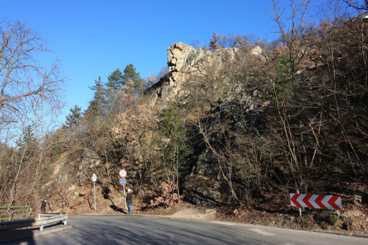
From here, the green triangle (Z ▲) hiking trail starts, which climbs to John’s Hill serpentine, essentially shortening one of its huge crooks below the summit on the new P ▲ route. From the former (now tidy) Horse Railway terminus, we walk along the sidewalk of Zugligeti út next to the lower station of the Gondola, and in the next turn, from above, the skull-breaking rock called Ominous towers from above. I have not found a source for the origin of the name of the rock, but it does not take much imagination to climb the small path that protrudes 15-20 meters high. The bare rock can be seen from the back of János Hill.
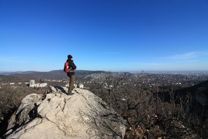
We turn off the road on a staircase hidden between the trees, from here the Z ▲ meanders through the forest, the first major stop of which is the Fairy Rock. The rock formation, which is well known to hikers and rock climbers, breaks heavily into the sky from the former quarry below, and it seems almost unbreakable. However, the hiking trail meanders past it, and even younger children can climb to the top from the shoulders of the mountain.
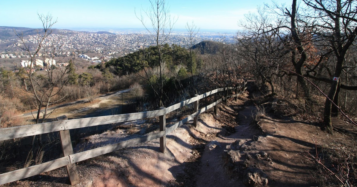
Standing on the cliff top, we get a taste of the beautiful slice of the panorama of the János Hill lookout tower. The view is literally heavenly – the original German name for the rock was Himmel (Heaven). From here, the roof of Tündér Hill – otherwise overgrown with trees – and the Tündérhegyi road passing through it, which is closed in front of car traffic, are only a small catcher. This is an important station because it branches off on the new P ▲ route.
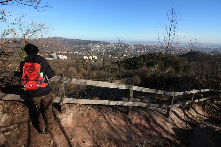
The new road starts immediately with a wooden staircase and soon reaches the beautifully rising edge of the Fairy Mountain quarry, which was previously secured with a wooden railing. The old path balancing on the edge of the rim was largely eaten by erosion, so the new hiking trail was built one line inland, with several wooden barriers in place for dizziness. The view is really nice from here too, although you can see a slightly smaller circular view from the capital than from the top of the Fairy Rock. The depths of the quarry are yawning darkly.
Not so long ago, a hundred years ago, picks clicked in a quarry on Fairy Mountain, mining dolomite, and fortunately in 1978 the area was declared a protected area, which slowly turned into a place to rest and hike. The mine has a fireplace with tables and benches, which is tempting for outdoor party lovers. Last June, police charged an illegal rave party of fifty people here.
Saying goodbye to the quarry, we walk quite steeply steeply, such an uncompromising catcher is called the “straight up the hill” route. In any case, there is one advantage: we reach the upper station of the Gondola and the bench-like panoramic terrace next to the buffet with lightning speed. This is the end of P ▲. We can sit down to relax, slip some tea out of the thermos. From here it is only a hump to the top of János Hill and the lookout on it, but if we are already here, it is not a bad idea to walk to the largest natural mountain lake in Budapest, called the sea eye, Lake Frog.
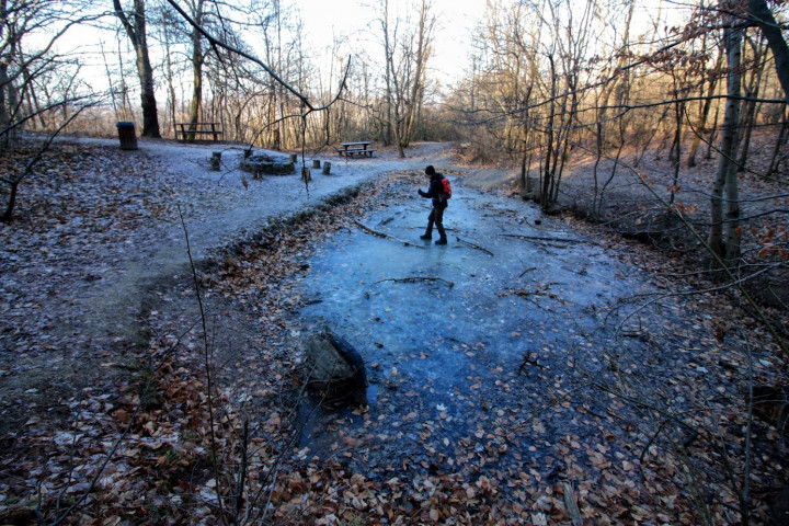
To do this, start on the red (stripe) hiking trail, but not towards the lookout, but in the opposite direction, into the woods. After a 400-meter walk, a sign shows where the stairs take you down to the lake. Lake Frog is special because stagnant waters are rare in the calcareous rock of the Buda Hills, but here the clay layer stretches in the riverbed. The lake freezes in winter. Its size is not very large, its depth can be half a meter. There is also a resting place, a fireplace, it can be a good picnic place in spring and summer.
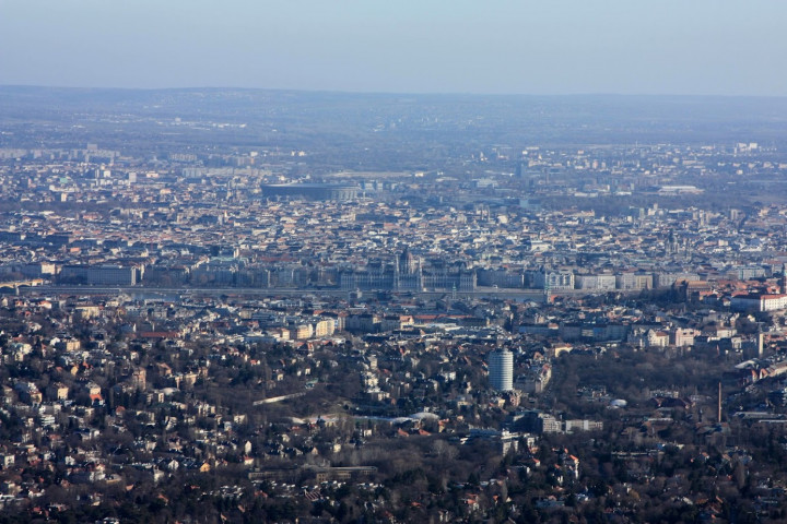
At Lake Frog we turn back and on the red hiking trail we climb back to the nearby peak of János Hill, also to the highest point of the Elisabeth Lookout Tower. This is the exact point of Budapest, and the panorama is also grandiose. Many people do not know that János Hill was formerly called Bratislava Hill, as it could be seen from the top to Bratislava Castle in good weather. (True, they rarely and upside down in the castle appear to be a meteorological phenomenon called aerial reflection.)
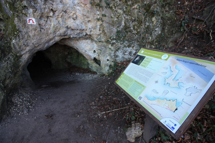
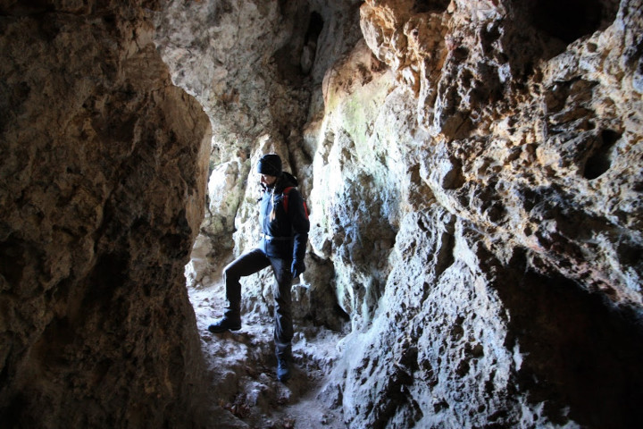
From the top back, it is more interesting to start at the PΩ sign, through the János Hill Passage Cave, and back to the Z ▲ road that winds down to the Horse Railway. On the steep hillside, the PΩ road also serpentines down to the cave, at the mouth of which an information board serves for information.
According to this, the official name János Hill Gateway is a gateway cave formed in a dolomite. It is a rare rock cavity: it has two openings, an entrance and an exit. It is on average 3 meters high and 18 meters long. It may be of thermal water origin, but its present form was judged by human hands, judging by the many chisel marks on the wall.
An average altitude of 3 meters at one of the entrances means that one adult has to go down a dwarf walk normally, while the other has a pretty high ceiling. No lights are needed when walking around, it’s just a little dark in the middle, but that’s all you need for excitement.
A short walk from the cave on the asphalt road to the Z ▲ hiking trail, which descends among the trees to a fairly sloping branch of the fairy-hill, where we started up on the road marked P ▲. We can look at another one at the Fairy Rock, it’s worth it, and then we’ll drive down the already familiar road to Zugligeti út, then under the Skullbreaker Rock to the Horse Railway building.
Zoom map here:
Parameters: the whole tour with the extra sights is a total of 7 km long, at a comfortable pace for 2-3 hours, but if you are not rushing through it, you can easily spend a short winter afternoon on it. The elevation is 350 meters in total, but it is still focused on a few harder catchers. There are always quite a few people at the Elevator Lookout, it’s better to get over them quickly. The Fairy Rock is also quite busy, but there are hardly any hikers at the lake, and almost no one at the Passage Cave.
More pictures of the tour here >>
More telex tours by clicking here >>