Weather – Bad weather “Elpida”: Snow already in Athens
The bad weather Elpis hits many areas of the country with the main characteristics of the weather being the political temperatures and the heavy snowfall.
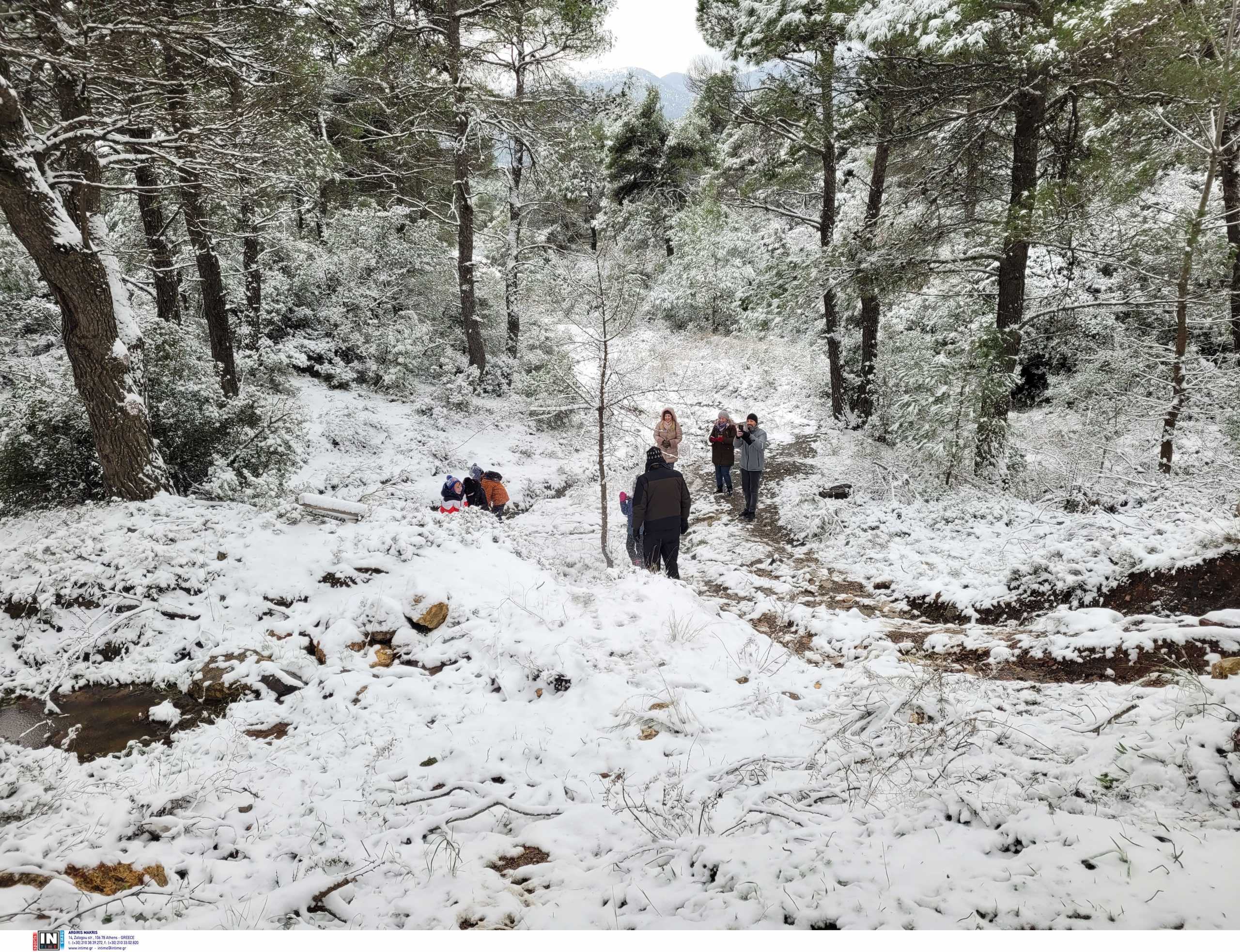
The Exception is not Attica, as we have snowfall since the early hours of Saturday in Ymittos, Parnitha and Penteli, however, without the bad weather to create particular problems with the most difficult to find the pillars.
The municipalities of Attica and especially in the north of the prefecture are on full alert in order to face the snowfall.
A total of 80 snow machines in Attica are on foot and are the roads from Friday night, while two and a half tons of salt will be available in 10 places so that the municipalities can be supplied. Two more will be on hand to free people.
Northern Greece in a white circle
The operation of the bad weather “Elpis” has already started from Northern Greece, which since Friday night has “dressed in white” many areas, heading south.
Xanthi “dressed in white” from the early morning hours of Saturday, without, however, creating any problems so far.
Watch live the evolution of bad weather
Polar temperatures and snow in Kozani, with the municipality and the region on foot.
The snow veil also covered Paliouri in Didymoteicho.
Snow has also covered Pelion.
Heavy snowfall from the early morning in Thebes.
The bad weather “Elpis” reached as far as Lesvos with the machines of the Civil Protection to fight to keep the road clean.
Snow already in Athens
At noon on Saturday, it snowed in the center of Athens and in areas such as Pagrati, Nea Smyrni, Maroussi and Kypseli, but without covering it.
The Hippocratic State was dressed in white and the families went there to enjoy the snow.
It is reminded that, due to the snowfall, roads have been closed. More specifically, Dionysos Avenue (Penteli Ring Road) was closed from the height of Agios Petros to Penteli, Dionysos Street (Dionysos Ring Road) from the height of “414” to N. Makri and Parnithos Avenue from the height of the cable car and at two traffic streams.
Shortly before 12:00 noon, the traffic was restored on the Avenue and Dionysos Street, while at the Buffy shelter the landscape is snowy, while the road remains closed.
How will the bad weather develop?
MEGA meteorologist Giannis Kallianos explained that the temperature has dropped significantly by 11 degrees in Attica and something that will continue.
The snowfall will continue, the cold will remain, while tomorrow Sunday we will have snow at low altitude even on the beaches. So to have snow in most areas of the Aegean, in areas of Evia and the Sporades.
Snowfalls are expected in Pelion and Attica in the north and east of the prefecture and at lower altitudes and possibly in the southern Peloponnese.
She will be dressed in white and in the center of Athens
The weather will show a very serious relapse on Monday and Tuesday. This means that snowfall will fall in the lowlands in Thessaly, Evia, central-eastern Sterea, Attica, and other parts of the country. From Monday noon and Tuesday morning we will have the peak of bad weather. It will snow even in the center of Athens, but also in coastal areas.
The Strong will be the frost in Northern Greece as well. Mercury will reach -20 degrees in some areas.
From Wednesday – Thursday the temperature should start to rise.
The weather forecast for tomorrow Sunday
On Sunday, temporary local rains or sleet are expected in the lowland and coastal parts of the Peloponnese and local snowfall in areas over 300 meters, which will quickly stop. Snowfall, according to the meteorologist of the National Observatory of Athens, is expected even in lowland and coastal parts of the Aegean islands, Evia, the Sporades and the eastern parts of Magnesia.
Rain or sleet is increasing in the lowland and coastal parts of Crete and in the western parts of the Dodecanese, snowfall is expected in areas with low altitudes above 200-400 meters. The snowfalls in Evia, in the Aegean islands and in the mountains of Crete that are locally strong. In the night and early morning hours there will be frost in most parts of the country, while locally on the mainland conditions of total frost will prevail.
The temperature – at very low levels and in a further drop in central and southern – will range in Western Macedonia from -14 to 0 degrees, in the rest of Northern Greece from -12 to 5, in Epirus from -12 to 6 degrees, in Thessaly from -13 to 5, in the rest of the mainland from -11 to 7, in the Ionian islands from -1 to 6 degrees, in the islands of the North Aegean from -2 to 3 degrees, and in the other island parts of the Aegean and Crete from -2 up to 7 degrees Celsius.
The winds will blow from north-northwest general directions with intensities up to 7 Beaufort in the seas.
In Attica, temporary clouds are expected with local snowfall, mainly in the north and east of the prefecture. The effects after noon do not weaken. The winds will generally blow northwest with intensities up to 5 Beaufort. The temperature will range from -3 to 5 degrees.
In Thessaloniki known clear weather with a few temporary clouds. The winds will blow northwest with intensities up to 4 Beaufort and in Thermaikos up to 5-6 Beaufort. The temperature will range from -3 to 3 degrees.