San Marino. Weather: cold perturbed front between Friday evening and Saturday morning (to be monitored) then sunny weekend
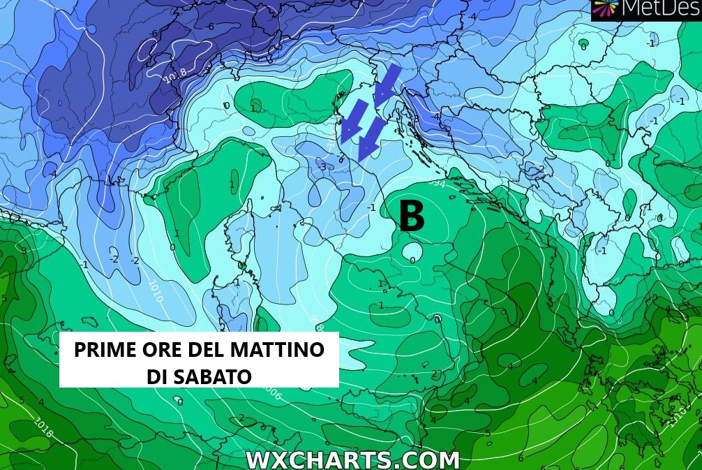
As he announces between Friday evening and Saturday morning a fast disturbed front will arrive, powered by Arctic air, what awaits us? The trajectory of the minimum depression will remain uncertain until the last, and the snowfall limit in San Marino is played on a tightrope, specifying on the positioning of the minimum during its transit from west to east, how much it will be able to magnetize cold air from North East. From the latest data available, probably the minimum of low pressure will follow the direction from the middle Tyrrhenian Sea towards the middle Adriatic (early morning on Saturday) and then descend towards the lower Tyrrhenian Sea and southern Italy. So at the beginning of the disturbance (Friday afternoon / evening) when the minimum will be on the middle Tyrrhenian Sea the winds will blow in San Marino from the south / southwest and the rains will prevail. then during the early hours of Saturday morning with the transit of low pressure towards the middle / lower Adriatic, strong winds from the northeast will begin to blow which will cause the temperature and the snow limit to drop, so it is not excluded that the rain may turn into snow from the early hours of Saturday morning starting from the highest altitudes in our area.
However, the disturbed front will pass quickly and already at the end of the morning, large clearings will open and the clear sky will return. The rest of the weekend will be spent with sunny skies and winter temperatures, minimums around zero and maximums around 5 ° C.