“Bomb” for a new Mediterranean cyclone – When does it arrive in Greece!
The weather today is relatively clear, but the situation will change radically in the coming days.
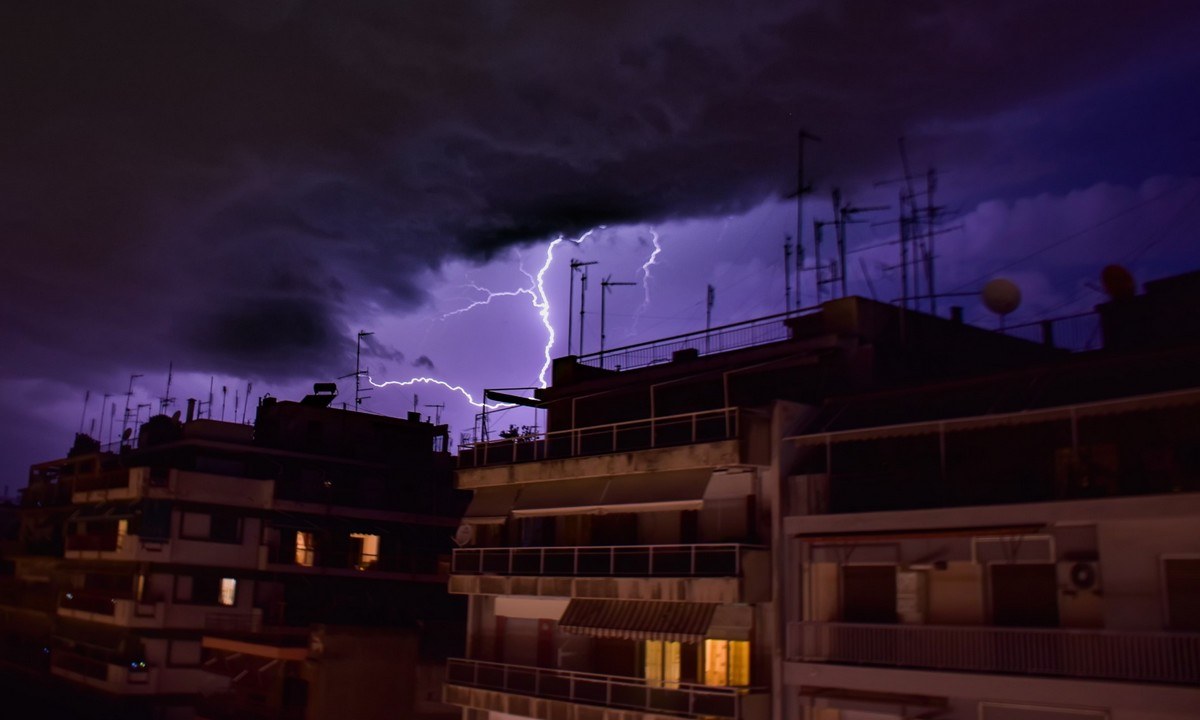
Weather today: His meteorologist Open, Klearchos Marousakis dropped… a bomb for a new Mediterranean cyclone, which has to “visit” Greece and bring with it intense phenomena.
The strong barometric low, located in southern Italy “hits” Sicily with lots of rain, thunderstorms and floods.
The phenomenon then has no specific days to come to the country in the coming days. In particular, the barometer that moves east to our country and will probably pass through the southern parts of the sea, bringing with it similar phenomena to those of Italy.
The wave of bad weather will mainly hit Crete and the Dodecanese with heavy rains on Sunday and Monday. Klearchos Marousakis points out that the course of the phenomenon is quite difficult to predict accurately.
Weather today – Detailed forecast:
Weather today – EMY forecast:
According to her forecast ΕΜΥ, today in the southern Ionian, western and southern Peloponnese and Crete clouds are expected with rain and isolated thunderstorms.
In the rest of the country, the weather is generally clear with temporary clouds in the eastern mainland, Evia and the Sporades.
In western Greece, the winds will blow east 6-7 beauforts and in the southern Ionian locally 8 beauforts. In the eastern country, the northern
the northeast will be intense 4 to 6 beauforts and in the Aegean locally will reach up to 7 beauforts.
The temperature should not change significantly. In the north it reaches 18, in the eastern Aegean 23 while in the rest of Greece it will range at 20 to 22 degrees Celsius.
ATTICA
A few clouds temporarily increased.
Winds: North northeast 4 to 5 and east 6 local 7 Beaufort.
Temperature: From 13 to 19 degrees Celsius. In the north 2 to 3 degrees lower.
THESSALONIKI
Generally clear with a few temporary clouds. Visibility in the morning will be limited in places.
Winds: Variable patients.
Temperature: From 06 to 18 degrees Celsius.
EUBOEA
A few clouds temporarily increased with a chance of light local rain.
Winds: North northeast 5 to 6 and south 7 Beaufort.
Temperature: From 11 to 18 degrees Celsius.
MACEDONIA, THRACE
Generally clear with a few temporary clouds in Thrace.
The visibility is in places limited in the morning.
Winds: Variable 3 to 4, in the east northeast 4 to 6 and from the afternoon in Thrace locally 7 beaufort.
Temperature: From 02 to 18 degrees Celsius. In western Macedonia which is in places 3 to 4 degrees lower and in the morning hours there is local frost.
IONIAN ISLANDS, EPIRUS, WESTERN STEREA, WESTERN PELOPONNESE
In the north generally clear with a few local clouds. In the south increased clouds with local rains and in the southwestern Peloponnese isolated thunderstorms.
Winds: East southeast 4 to 6 and in the southern Ionian 7 to 8 Beaufort.
Temperature: From 09 to 22 degrees Celsius. In the interior of Epirus 3 to 5 degrees lower.
THESSALY, EASTERN CENTRAL, EASTERN PELOPONNESE
In the eastern Peloponnese increased clouds mainly in the south, where local rains and possibly isolated thunderstorms will occur.
In the rest of the regions clouds temporarily increased with the possibility of weak local rains.
Winds: North northeast 4 to 6 and in the east and south local 7 Beaufort.
Temperature: From 09 to 21 degrees Celsius. In the north 3 to 4 degrees lower.
CYCLADES, CRETE
Cloudy skies temporarily increased, with local rains in the south and in Crete isolated thunderstorms.
Winds: North 4 to 6 and in the west northeast locally 7 Beaufort.
Temperature: From 15 to 21 degrees Celsius.
EASTERN AEGEAN ISLANDS – DODECANESE
Generally clear, with a few local clouds that will increase at night in the Dodecanese and local rains are likely to occur.
Winds: North northeast 6 to 7 Beaufort. South north northwest 3 to 5 Beaufort.
Temperature: From 17 to 23 degrees Celsius. In the north 4 to 5 degrees lower.
/cloudfront-eu-central-1.images.arcpublishing.com/madsack/NUWZCWCJRJBIJHU5AUO5EXOHDY.jpg)
/cloudfront-eu-central-1.images.arcpublishing.com/madsack/NHW556UKZ5AVBM47OAWSYLJCPQ.jpg)