Antwerp city route planner guides cars away from Turnhoutseb… (Antwerp)
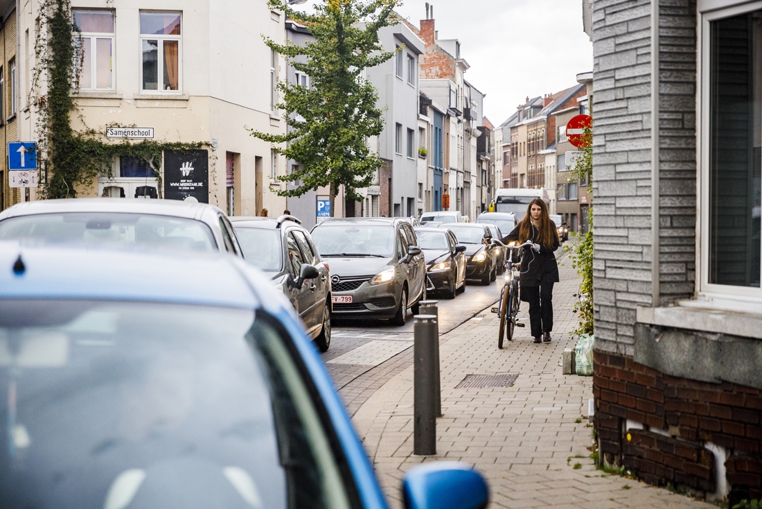
The daily bustle in the Borsbeekstraat. — © Victoriano Moreno
The route planner of the urban mobility website Slim to Antwerp ignores the Turnhoutsebaan in Borgerhout. Cars are sent out of the city via residential streets, the Turnhoutsebaan has the function of receiving these cars and thus save the residential streets. Mobility ships Koen Kennis (N-VA) reports an error in the route planner.
Sacha Van Wiele
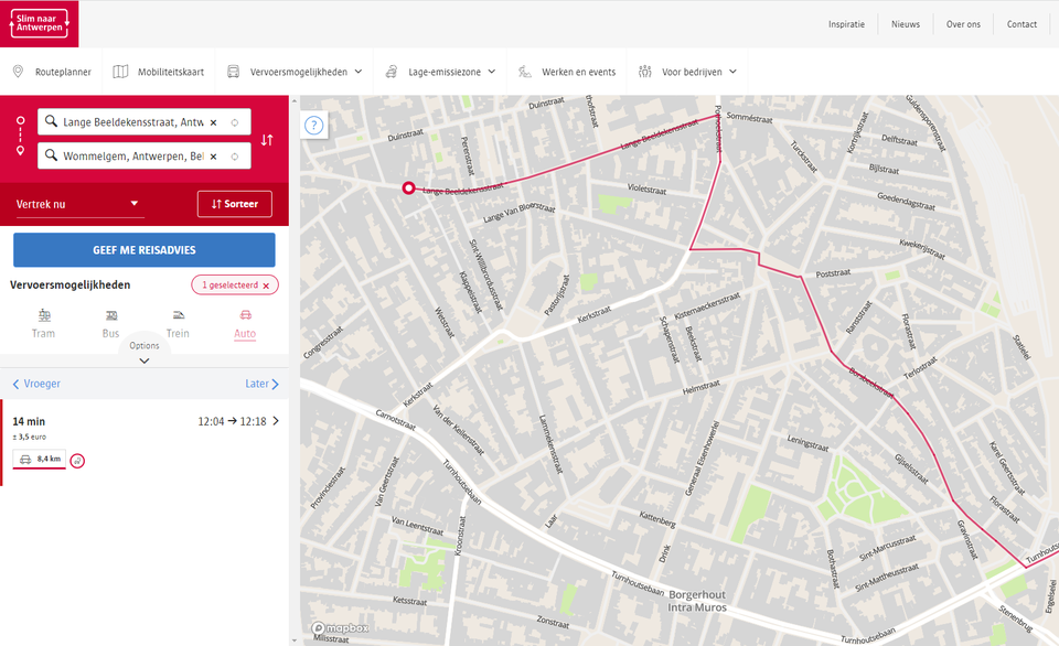
The route planner to Antwerp helps people to plan their route smartly, both on foot, by bicycle, public transport and car. The user can choose between, among other things, the smartest of the fastest route.
In the Antwerp mobility plan, the streets were all given their own function, including the Turnhoutsebaan in Borgerhout. This street is a neighborhood road. Such a street should collect and open up traffic. However, this logic does not seem to have been extended in the route planner.
For example, anyone who wants to drive from Lange Beeldekensstraat to Wommelgem by car will not be led directly to Turnhoutsebaan. The route planner proposes to drive via Pothoekstraat to Borsbeekstraat and then to Turnhoutsebaan via Gijselsstraat. happens for those departing from Helmstraat or Diepestraat.
The result is that residents in the Borsbeekstraat are regulated with files in their residential street. Counting in 2018 showed that five thousand cars drive through this residential street every day. That’s 1.5 million a year.
© RR
In response to the question from the editors of Gazette of Antwerp about this use between policy and the route planner, the system behind the route planner was examined. This showed that there is actually a problem and that cars are incorrectly sent into residential streets.
File
The route planner maps out a route based on information from other mobility applications from historical data. It therefore also takes into account the possible traffic congestion in the streets.
“These applications outside also when suppliers stand still for deliveries in, for example, the Turnhoutsebaan”, says Antwerp mobility alderman Koen Kennis (N-VA). “The rhythm behind our route planner wrongly thinks that those vehicles are standing still in a traffic jam and that that traffic jam is there all day long. The result is that, based on that historical data, motorists are transferred to avoid the Turnhoutsebaan. As a result, the cars drive through the residential streets.”
Ships Knowledge says this cannot be the intention. It is the intention, however, to leave the zone 30 in the residential streets as quickly as possible and, in this case, to direct motorists to the Turnhoutsebaan.
“That weighting is in our route planner, but the data from the mobility applications has polluted the system somewhat,” says Kennis. “The emphasis in this route planner is on people who use a combination of modes of transport on foot, bicycle and public transport. Based on this information, we will now better filter the information we get from the mobility applications.”
ALSO READ: Antwerp police negative about bicycle street in Turnhoutsebaan: “Traffic situation with false safety”